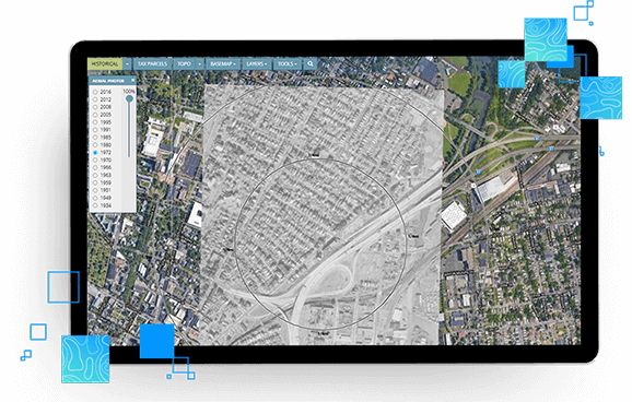
Improve the data review process with the leading site assessment data viewer….
Learn moreEDR Historical Aerial Photos
The largest collection of historical aerial photos in the US
Get the best coverage from a single search with EDR Historical Aerial Photos — including digitally reproduced photos from each decade, often beginning in the 1930’s and continuing to present day.
Request A Demo Order Now
Access the industry leading collection
Access a constantly-updated collection, including new additions and continuous improvements to existing photos.
Outline your target property
The polygon you delineate in the order process is carried through on all georeferenced historical aerial images, saving significant time reproducing the polygons on a set of aerials.
View historical aerial photos in multiple formats
Review historical aerial photos as PDFs or through EDR LIGHTBOX® Viewer when purchased with an EDR® Package or Radius Map.
Customize requests
Need a large or irregularly shaped site photo (such as for roadways, railroad lines, and utility corridors)? We can help—contact for more info.
Review photos in LIGHTBOX EDR
View historical aerials alongside government records, other historical resources, and other important data layers.
LightBox EDR’s historic topographic map collection
Historical aerial photos help you determine past property uses, locations of old buildings, roads and equipment, past-conditions of vegetation and other features that could be key indicators of recognized environmental conditions on a site.
The photos can be reviewed in traditional PDF format or, when purchased with an EDR® Package or Radius Map, through LIGHTBOX EDR.

Connected Data
Parcel Boundaries
Nationwide parcel boundaries with 300+ property and tax attributes to help you make more confident decisions. Covers 3,100+ U.S. counties including territories, with over 150 million parcels with polygon geometry that is completely normalized.
Other Environmental Content
Content valuable for evaluating environmental issues, including historical gas station and dry cleaners, PFAS, water wells, oil and gas wells, radon, wetlands, topography, endangered species, registered historic sites, and more.
Historical Imagery and Content
Collection of historical content including SANBORN® Maps, Historical Aerial Photography, Historical City Directories, Historical Topographic Maps, Environmental Liens and AULs, and Historical Title.
Recommended Insights

Zoning and Land Use Considerations for Data Centers

FedWatch: HUD Changes Under the Trump Administration and Its Impact on Commercial Real Estate
